


UAV Aerial Videography + AI Image Recognition to Help Localities Maintain Safety at Intersections
- Date:2021-09-01
- Update:2024-01-31
- Department:Transportation Safety Division
With the rapid development of Unmanned Aerial Vehicle (UAV) Aerial Videography and Artificial Intelligence (AI) Image Recognition technologies in recent years, the Institute of Transportation of the Ministry of Transportation and Communication cooperated with C-LINK Technology Inc. to combine these two technologies to identify and track the flow trajectory of vehicles and pedestrians at intersections from the "View of God" of Unmanned Aerial Vehicle (as in Figures 1 and 2). The study analyzes the locations and types of traffic conflicts at intersections (as in Figure 3) through software to take action in the early stages to prevent accidents from happening, and cooperated with the two Cities of Taipei and Kaohsiung in 2021 by selecting related intersections to conduct analysis and research. Deputy Director-General Huang, Rong-Hui of the Transportation Bureau, Kaohsiung City Government, specially arranged to lead colleagues from the Transportation Bureau to the intersection of the City’s Qixian 1st Road, Qixian 2nd Road, and Zhongshan 1st Road to observe the UAV Aerial Videography operations on the afternoon of August 31, 2021 (as in Figure 4, 5). This event helps to communicate relevant topics of discussion with the Research Team of the Institute of Transportation, and discusses with colleagues of the Transportation Bureau how to use this technology and innovative analysis tool to help the Kaohsiung City Government to diagnose intersection safety issues, and thereby reduce the number of traffic accident casualties in the future.
In the past, the Road Competent Authorities were required to collect and analyze traffic accident data for 1 to 3 years before they could find safety issues at intersections and make improvements to prevent accidents from happening. In order to take action in the early stages to keep accidents from happening, the Institute of Transportation has combined two latest technologies in recent years: UAV Aerial Videography and AI Image Recognition to solve the problem of traffic conflicts at intersections. In the operation, first use the UAV 75-80 meters above the intersection to take a bird's-eye view of videography to clearly capture the flow of vehicles and pedestrians at the intersection, and then use AI image recognition technology to convert the images into the trajectory of vehicles and pedestrians, and finally analyze the trajectory data through software, to identify the positions and types of traffic conflicts at intersections, that is, the places most prone to accidents, to assist the Road Competent Authorities in diagnosing possible dangerous hot spots at intersections and make improvements in advance; in addition, it can also compare the changes of conflict hot spots before and after the improvement to evaluate the effectiveness of the improvement.
The Institute of Transportation plans to select two intersection safety issues every year from 2021 to 2023, and cooperates with Local Governments to select intersections for analysis. Because the severity of traffic accident is relatively high in the two situations of "left turn and opposing through traffic" (i.e. when there is no left-turn only signal, making left turn by taking the chance of the gap between the vehicles at the opposite direction ) and "intersection crossing conflict" (i.e. conflict between the directly moving vehicle and horizontally moving vehicle due to running an amber light or a red light, etc.). The issues were communicated with the six Municipalities in a symposium in 2021, in addition to cooperate with the two Cities of Taipei and Kaohsiung to select 15 intersections for research, also selected four intersections prone to accidents in Taipei City, Taoyuan City and Tainan City for analysis, as the basis for follow-up improvement. In addition, in order to promote this innovative analysis tool, the Institute of Transportation also plans to organize an education and training course in late October 2021, inviting personnel from Road Management Agencies and Consulting Companies to participate in order to understand the operating procedures of UAV Aerial Videography, the principles of AI Image Recognition, functions and operating procedures of Analysis software, and other topics, for the Practicing Units to use the technologies widely in the intersection traffic safety diagnosis and improvement, to enhance safety at intersections.
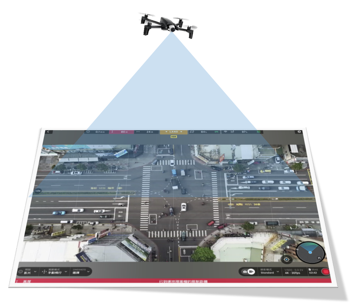 Figure 1: Schematic Diagram of Unmanned Aerial Vehicle (UAV) Aerial Videography
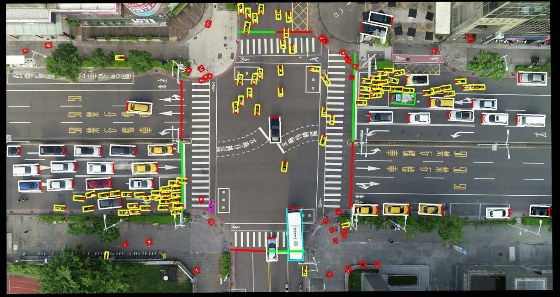 Figure 2: Automatic Image Recognition of Automobiles, Motorcycles and Pedestrians
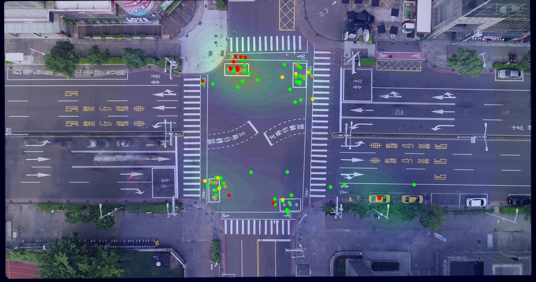 (Red: Imminent Danger Conflict, Orange: High-risk Conflict, Yellow: Medium-risk Conflict, Green: Low-risk Conflict)
Figure 3: Intersection Conflict Hot Spots Map (Degree of Conflict is Represented by Different Colors)
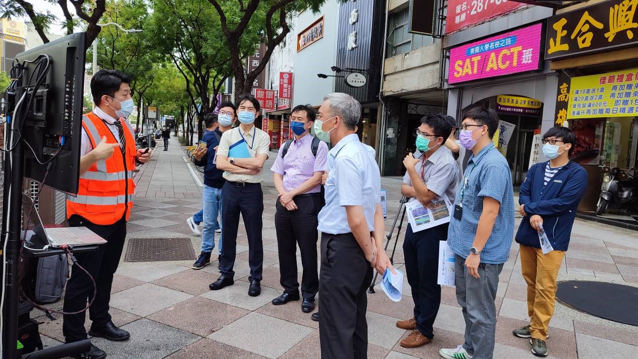
Figure 4: Deputy Director-General Huang, Rong-Hui of the Transportation Bureau, Kaohsiung City Government (4th Person from the Right) observes the UAV Aerial Videography operations on site
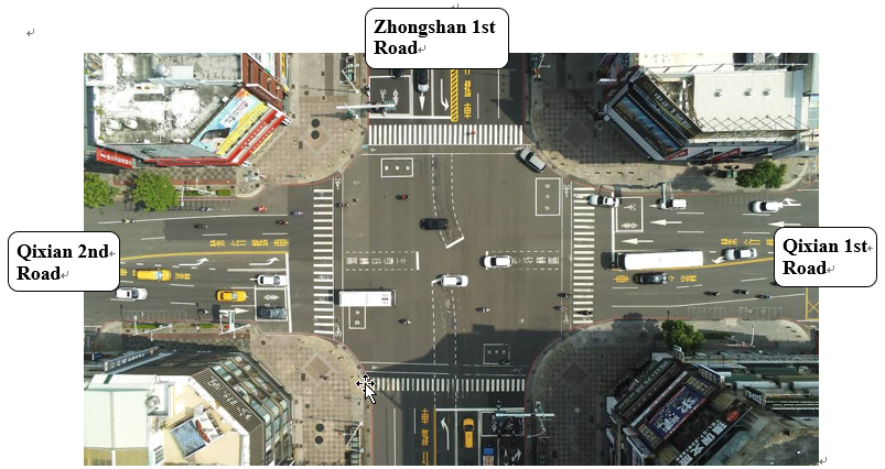
Figure 5: Image of UAV Aerial Videography at the Intersection of Qixian 1st Road, Qixian 2nd Road, and Zhongshan 1st Road of Kaohsiung City
File Download
- 20210901-news.pdfCounter:228